Kabylie and High Plateaus
From snow-capped Djurdjura to the Roman cities of Djemila and Timgad, a 400-kilometer journey through hilltop Berber villages and steppe-like High Plateaus.
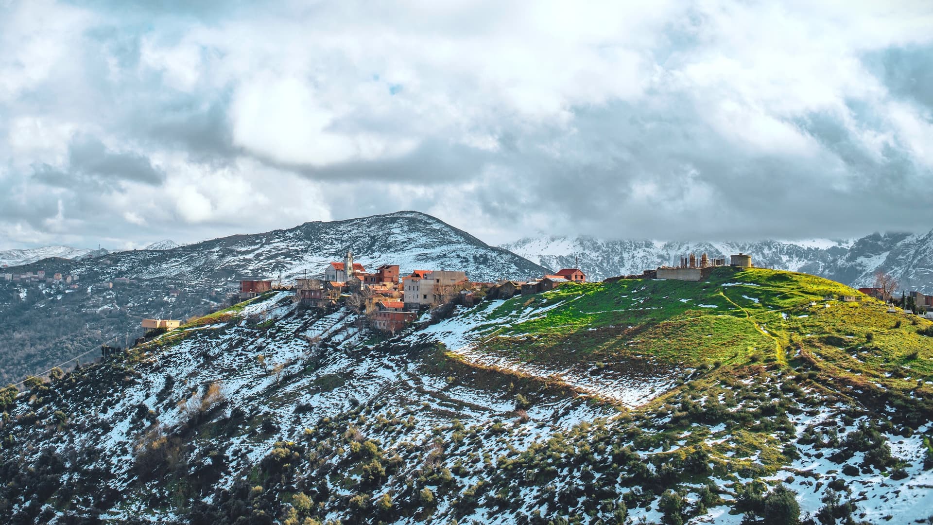
Kabylie begins an hour's drive east of Algiers, where the Mitidja plain gives way to the first foothills. The Djurdjura massif, crowned by Lalla Khedidja at 2,308 meters, defines the entire region: its limestone crests retain snow from December to April and feed the springs that descend toward the Soummam and Sébaou valleys. It is a land of perched villages, built at height for defensive and climatic reasons. Aït Yenni, Aït Hichem, Beni Yenni: these compound names recall the tribal confederation organization that long structured Kabyle society.
Here, Kabyle is spoken—a variant of Tamazight—and English remains very much present. Our team works with families who maintain local crafts: silver niello and coral jewelry in Aït Yenni, hand-molded pottery without a wheel in Maâtkas, weaving in Aït Hichem. Olive growing sets the rhythm of autumn, with harvesting from November to January and presses turning in every village. Couscous with melted butter, barley flatbread cooked on an earthen tajine, berkoukes: Kabyle cuisine is hearty, rustic, built for cold winters.
South of Djurdjura, the landscape softens. The High Plateaus stretch nearly 600 kilometers east to west at an average altitude of 900 meters. The terrain becomes steppe-like, dry, dotted with salt lakes and cereal crops. This is an Algeria often overlooked by travelers, yet it holds the best-preserved Roman heritage of the Maghreb. Djemila, ancient Cuicul, sits on a 900-meter spur: its forum, theater built into the slope, and mosaics from the House of Bacchus remain in place. Timgad, founded by Trajan in 100 AD as a veteran colony, spreads across nearly 50 hectares in an almost intact checkerboard plan, complete with its so-called Arch of Trajan, library, and 3,500-seat theater. Tipaza lies on the coast, but Djemila and Timgad alone warrant the journey to the High Plateaus.
Sétif, at 1,100 meters, serves as a practical logistical base for exploring Djemila. The city bears traces of its Roman past (the museum houses the Triumph of Dionysus mosaic) and remains marked by the events of May 8, 1945. Further east, Constantine clings to a rocky pinnacle carved by the Rhumel gorges, plunging 200 meters deep. Four bridges link the old city to modern quarters, including the suspension bridge Sidi M'Cid, built in 1912 and 168 meters long. The medina, the Bey Ahmed Palace, and malouf music make Constantine the cultural capital of eastern Algeria.
Between the two, the national road crossing maritime Kabylie offers another perspective: Béjaïa and its Carbon Cape, the Gouraya National Park, cliffs plunging into the Mediterranean. Tizi Ouzou, the administrative capital of Kabylie, serves as the urban pivot. This diversity of altitudes and identities within a 400-kilometer radius makes the journey rich.
To Discover
The Djurdjura massif and Aït Yenni. Hikes along limestone crests between 1,800 and 2,300 meters, visits to the jewelry workshops of Aït Yenni where silver is carved according to Berber patterns unchanged since the 19th century.
Timgad, Trajan's Roman city. 50 hectares of checkerboard plan preserved at 1,000 meters altitude, with triumphal arch, theater, and baths. Allow a full half-day to walk through the site.
Djemila and its mosaics. UNESCO-listed site perched on a spur between two river valleys. The adjoining museum preserves in situ the pavements of Bacchus and Asterios, among the best preserved in North Africa.
Constantine, city of bridges. Walking tour across the four bridges spanning the Rhumel gorges, then strolling through the medina toward the Bey Ahmed Palace, adorned with Ottoman frescoes and faïence.
Olive harvesting in Kabylie. From late October to early January, spend a day with a family in Tizi Rached or Aït Yahia: picking, transport to the village mill, tasting with warm flatbread.
When to Visit
The best period to combine Kabylie and the High Plateaus runs from April to June, then September to mid-November. In spring, almond and cherry trees bloom in Kabylie from March onward, temperatures oscillate between 12 and 22 degrees Celsius during the day, and Roman sites can be visited without summer heat. Autumn offers similar conditions with lower-angle light, ideal for photography at Djemila and Timgad.
Summer, July to August, is frankly hot on the High Plateaus: 35 to 38 degrees are common in Sétif and Constantine, and exposed archaeological sites become exhausting after 11 a.m. Kabylie remains more pleasant at altitude. Winter, December to March, sees Djurdjura snow-covered (the Tikjda station sometimes closes roads after snowfall), and rain is frequent, with nighttime lows near freezing. It's a viable season for the High Plateaus if you accept dry cold and wind.
Practical Tips
We recommend 6 to 8 days to travel this loop without rushing: 2 days in Kabylie around Tizi Ouzou and Djurdjura, 1 day at Sétif and Djemila, 1 day at Timgad, 2 days in Constantine, plus travel time. Distances are long: 300 kilometers between Tizi Ouzou and Sétif, 240 kilometers between Sétif and Constantine, on decent highways but with mountain sections. The most logical entry point remains Algiers Airport to start with Kabylie, or Constantine Airport to loop in reverse.
The region naturally combines with Algiers and the coast beforehand (2 to 3 additional days), or with the Aurès and Northeast beyond, extending toward Batna, expanded Timgad ruins, and the possible descent to Biskra and the northern Sahara. Hotel comfort is satisfactory in cities (Sétif, Constantine, Béjaïa) but more rustic in Kabyle villages, where we favor family guesthouses. This journey suits curious travelers interested in history and living cultures, contemplative types, occasional walkers. Families with children from age 10 find it appealing, especially in spring.