Grand Erg Occidental
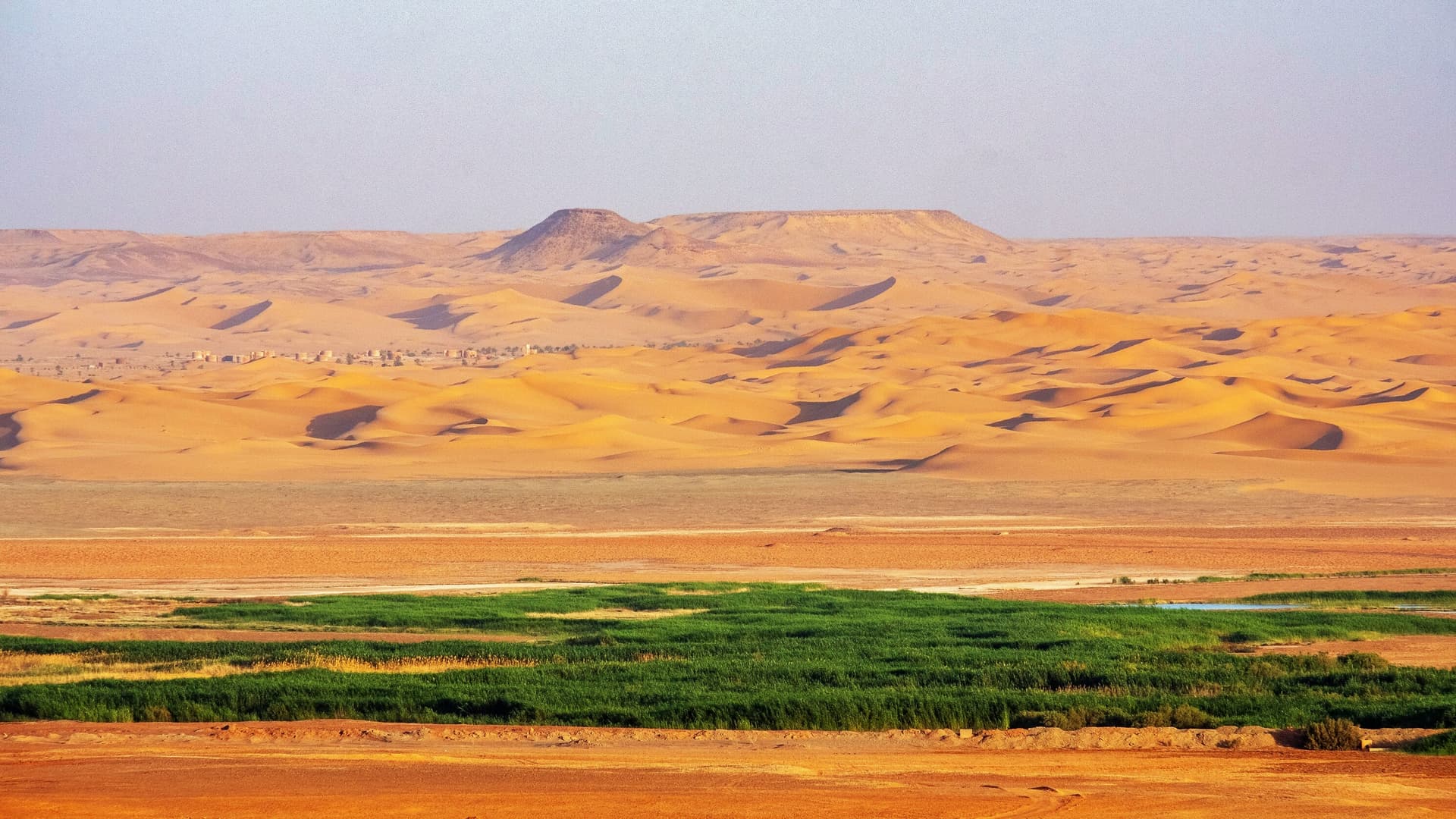
The Grand Erg Occidental is an immense crescent-shaped sea of sand spanning 80,000 km². You will find no mountains here, yet its dunes rise to heights of 120 m. Travel through it proves challenging.
The Grand Erg Occidental is an immense crescent-shaped sea of sand spanning 80,000 km².
You will find no mountains here, yet its dunes rise to heights of 120 m. Travel through it proves challenging for camels, whose great trans-Saharan caravans followed routes marked by natural obstacles for nearly two millennia: the Tademait plateau to the south, the Saoura valley to the west, and the Anti-Atlas to the north.
They form a complex system of small dune massifs enclosing depressions of gray sand. The contrast is striking between the luminosity of the ochre dunes and the dark expanses of these depressions.
Geologists estimate that this erg began to form during the Quaternary, more than 31,000 years ago, when Saharan aridification became severe enough to free sand from vegetation's grip. The sand is either red and coarse, or yellow and fine. This sand was not carried by wind; the erg was nourished by alluvium from three Quaternary rivers flowing from the Atlas (Zousfana, Gharbi, Saoura) during a more humid era; it now covers their ancient flood plains. Contrary to what one might expect, fauna is not absent from the erg.
Beyond vegetation sometimes abundant in depressions and hollows, countless small traces prove that wildlife is indeed present.
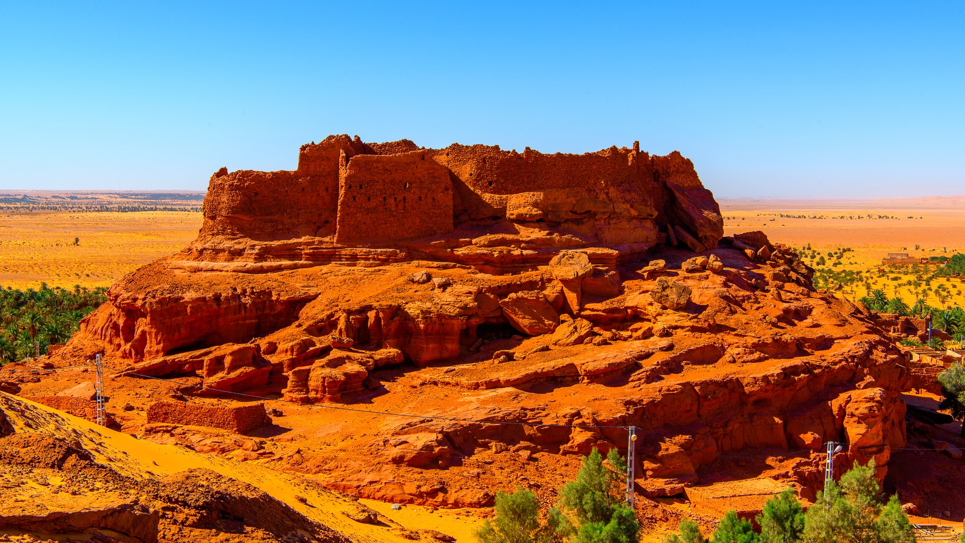
The Gourara forms the southwestern border of the Grand Erg Occidental. Timimoun is the most important oasis in this region, where a multitude of small villages have flourished. These settlements nestle at the foot of enormous fortified structures of stone or clay, each possessing its own palm grove. Timimoun: the ochre-hued city sits at the edge of a stony hamada and overlooks a lush palm grove bordering the pink and white sebkha; in the distance an endless sea of dunes draws the eye toward infinity.
Flora
Here are some plants that still grow among the dunes: rtem (Retama, white-flowered broom), lazal and alenda (two shrubs), tasekra (a type of thistle), had (excellent camel pasture, Cornulaca monocantha) and drinn (Aristida pungens, a grass). After good rainfall, a temporary pasture of annual plants (acheb) appears and delights camels and herds alike.
The erg can be considered stabilized. Only its superficial appearance changes (ridge lines, sif). An excellent proof of this stabilization is the unchanging location of major wells.
Fauna
Contrary to expectation, fauna is far from absent from the erg. Beyond vegetation sometimes abundant in depressions and hollows, countless small traces prove that wildlife is indeed present: grazing camels, gazelles (rym in Arabic, Gazella dorca), hares, hedgehogs, fennecs, jerboas and gerbils, various birds including the famous raven always hovering near bivouacs!
Vipers (lefaa in Arabic, Cerastes vipera) and scorpions are exceptionally visible during travel seasons. The skink (Scincus scincus), or sand fish, is often captured by children. Insects are mainly represented by beetles.
History of Gourara
The Gourara forms the southwestern border of the Grand Erg Occidental. Timimoun is the most important oasis in this region, where a multitude of small villages have developed. More than one hundred villages exist here. Establishing a precise history of Gourara is difficult due to a lack of written documentation.
During the Neolithic, this region was certainly densely populated. Numerous flakes of worked flint scatter the ground, attesting to this. Two-thirds of the villages or "ksour" speak a Berber dialect: Zenati. This predominance was once more marked, as evidenced by village names.
The Zenati are first mentioned in Gourara's history in the 7th century. At that time, populations of Jewish and Sudanese origin occupied the region. Subsequently, Arab conquest drove other Zenati tribes to seek refuge in Gourara and Touat. In the 10th century came the fall of the Obeidite empire and new Zenati tribes, followed by Arab populations, resettled in Gourara. The 12th century marked the end of Zenati population settlement.
As noted, these tribes found the region already inhabited by Jewish populations so numerous that they became Judaized. From this Judeo-Berber foundation emerged the present-day Zenati. Originally nomadic, they became sedentary and built numerous ksours. The process was identical for Arab tribes, whose settlement continued in the 12th century, then in the 14th, 18th and 20th centuries. By 1900, the Chaamba followed French settlement.
Life in Gourara
Villages nestle at the foot of enormous fortified structures of stone or clay. Oral tradition suggests the oldest were built around the 10th century. The great construction period likely ended around the 16th century. Most of these fortresses were permanently abandoned during the second half of the 19th century, certainly due to water scarcity. Each village possesses a palm grove. Gourara is estimated to contain between 450,000 and 600,000 palms, though yields remain modest. Depending on species, a palm tree produces fruit only once every two years, yielding 12 to 100 kg. Within the palm groves lie gardens cultivating cereals (wheat, barley, sorghum, mekrout) and various vegetables. Irrigation is achieved either through the foggara system, by bucket wells, or increasingly through pumps. Livestock raising is modest: a few camels, "dahmane" sheep, and goats.
The Foggaras
This network of underground channels draining aquifers contained in sandstone is perhaps the most remarkable aspect of this region. While the principle exists elsewhere, nowhere is it as developed: from Touat to Gourara, no fewer than 200 km of galleries have been excavated. Only oases situated near a plateau can benefit from this continuous irrigation method. Oases within the erg must draw water from wells.
Water drainage is achieved through a very gently inclined gallery, beginning at garden level. Vertical shafts spaced 10 to 20 m apart, sometimes deeper than 40 m with diameters of 60 to 80 cm, are connected by a gallery of equal diameter in a gentle, steady slope until it penetrates the water table. The gallery then functions like a horizontal well! The difference is that water flows by gravity alone, requiring only regular maintenance, which the shaft construction facilitates. As the water table drops through depletion or climatic deterioration, centuries of deepening the shafts becomes necessary to rebuild galleries at lower levels. The major consequence is the downstream displacement of gardens when terrain permits. Gardens become trapped between increasing soil salinity—heightened near sebkhas by soil leaching due to fertilizing and irrigation—and the upstream water table level. Hence, in part, the abandonment of sites through history and the abundance of ruins.
One measures the human effort expended by slaves employed in these titanic tasks, armed only with picks and baskets. Lacking maintenance, much of these foggara system has today been abandoned and collapsed.