Tin Merzouga, Tadrart Rouge
Tin Merzouga, Tadrart Rouge
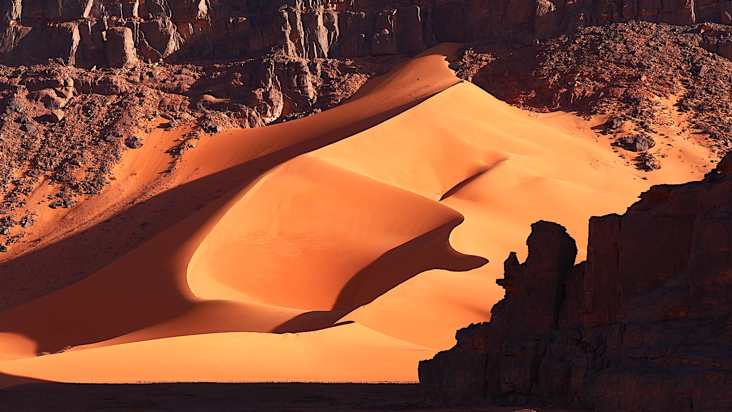
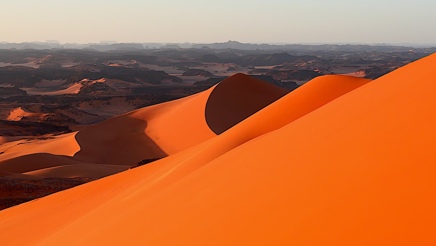
Located in the Tadrart Rouge in southeastern Algérie, Tin Merzouga ranks among the country's highest dunes, at the heart of the UNESCO-listed Tassili n'Ajjer.
Located in the Tadrart Rouge, in the far southeast of Algérie, Tin Merzouga ranks among the country's highest dunes. Its summit reaches approximately 1,300 meters in elevation, overlooking a sandy landscape that stretches to the Libyan and Niger borders. The site is accessed from Djanet, the region's principal caravan hub, after several hours of track through the Tassili n'Ajjer massif.
Why visit Tin Merzouga
The dune lies at the heart of one of the Sahara's most spectacular sectors. The surrounding massif combines dune cordons, sandstone canyons, gueltas (permanent water pools), and rock formations sculpted by erosion: pinnacles, arches, columns. The region belongs to the Tassili n'Ajjer, inscribed on UNESCO's World Heritage list both for its landscapes and for its exceptional concentration of prehistoric rock art.
Tin Merzouga itself stands out for the color of its sand, which shifts from white to orange-yellow depending on slope orientation and daylight. The summit climb, demanding yet accessible to fit hikers, opens onto a broad panorama of the Tadrart and neighboring ergs.
History and paleo-environment
The Sahara was not always a desert. During the Wet Holocene, between approximately 10,000 and 4,000 years before our era, the region enjoyed a milder climate, with savannas, permanent water sources, and fauna comparable to present-day East Africa. Along the Oued In Djaren, which crosses the area, rock engravings testify to this era: hunting scenes, herds of domestic animals, representations of elephants and other species now disappeared from the Sahara.
With the progressive desertification of the Sahara, settled herding populations adopted a nomadic lifestyle, refocused on camel herding, the sole livestock adapted to extreme aridity. The Kel Ajjer Tuaregs, who still occupy the region, are the heirs to this transition.
What to see on site
- The great dune: its ascent is generally made early in the morning or late afternoon, when the sand is less hot and light more oblique.
- The engravings of Oued In Djaren: on the sandstone walls bordering the wadi bed, several engraved panels are visible along the track.
- The rock formations of the Tadrart: arches, towers and stone cities, often incorporated into multi-day itineraries.
- The gueltas: these permanent water sources harbor relict vegetation and attract discreet Saharan fauna.
- The bivouac: spending the night under canvas, near the dune, is an integral part of the experience, with a sky particularly free from light pollution.
Practical information
Access to the Tadrart Rouge is exclusively by four-wheel-drive vehicle, accompanied by an approved local guide. A circulation permit is required to enter the national park, generally managed by the agency or guide in charge of the circuit. Plan several days on site to make the journey worthwhile: typical Tadrart itineraries last from 5 to 10 days.
Bring bivouac equipment, clothing suited to temperature swings, sun protection and sufficient water supplies. Telephone and internet do not work on most of the route.
When to go
The best period extends from October to April, when daytime temperatures remain manageable for hiking and driving. In mid-winter (December-January), nights can drop near freezing: a warm sleeping bag and several layers of clothing are essential. Summer months (June to September) should be avoided, as heat makes exploration dangerous.
How to get there
The logical starting point is Djanet, connected by domestic flights from Algiers. From Djanet, Tin Merzouga lies approximately 200 km to the southeast by track, meaning one day of progression in a 4x4 depending on the itinerary chosen and stops made along the way. No paved road serves the site: organization necessarily goes through a local agency or independent guide holding the necessary permits.
Nearby
- Tassili n'Ajjer National Park: the plateau extending the Tadrart to the north, famous for its rock frescoes.
- Saharan fauna: to understand the species that still populate these arid expanses.
- Hoggar National Park: volcanic massif located further west, another highlight of the Algerian Sahara.
- Assekrem: high plateau of the Hoggar renowned for its sunrise panoramas.
Frequently asked questions
Frequently asked questions
The dune's summit reaches approximately 1,300 meters in elevation. The height of the dune itself, measured from its base, is substantially less and turns around 300 meters, which nonetheless places it among Algérie's most imposing dunes.
No. Access to the Tassili n'Ajjer park requires an approved guide and a circulation permit. The logistics (4x4, supplies, navigation off marked track) makes an independent visit unrealistic for foreign travelers.
Standard circuits last from 5 to 10 days from Djanet, allowing you to combine Tin Merzouga with the region's main engraving sites, gueltas and rock formations.
Yes, especially between December and February. Nights can drop near freezing in the desert. A warm sleeping bag and thermal clothing are essential outside the warm season.
Preparing your trip
Tin Merzouga fits into a broader itinerary across the Algerian Sahara, generally combined with other Tadrart and Tassili sites. To explore the region in ideal conditions, consult our Algérie travel suggestions.
Interested in this visit?
We can include it in your personalised itinerary.